For at least 130 years there has been a “jog” on Dewey Avenue at Driving Park Avenue. If you wanted to continue on Dewey going north of Driving Park you had to turn right and then in 300 feet or so make a left turn and continue going north (see the map from 1899). The southern part of Dewey was originally known as Thrush Street but the name was changed in honor of Admiral Dewey after winning the Battle of Manila Bay during the Spanish-American War.
Driving Park Avenue was a major land line and the areas south and north were developed at different times. Also there was the Driving Park that was a track for harness racing and the road had to go around the track grounds.
Finally after all this time the City of Rochester is making the jog into a curved section so that there is only one traffic light at the corner of Dewey and Driving Park (see the construction map). The first part of the project was for the City to acquire the former Family Dollar store that was on the northwest corner. It was knocked down as part of the new road alignment goes through that store’s old parking lot. The project is almost done. The roads are in the new alignment and only some landscaping needs to be completed.
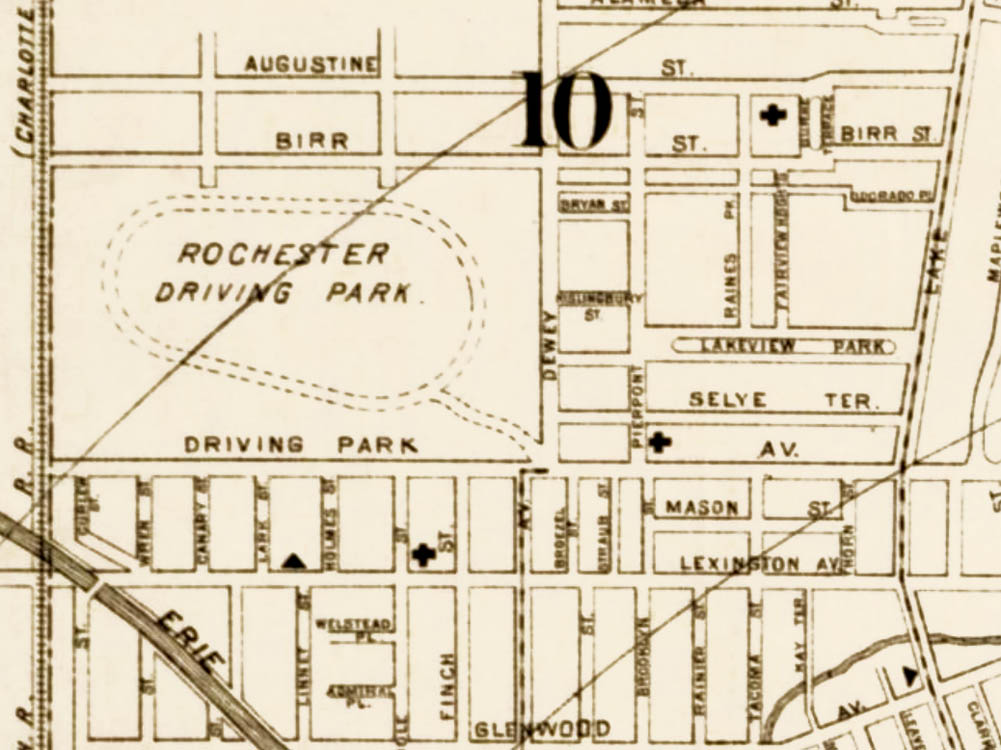
1899 map of the neighborhood
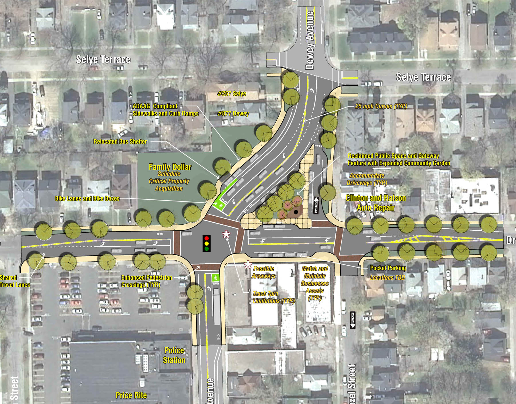
Construction area map